How do riders find designated motor routes?
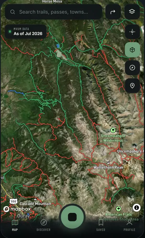
Compare motorcycle and OHV route designations with USFS MVUM, BLM GTLF, CPW and mapped road-network context, including available seasonal-use details.
Topo Colorado is a motorcycle-first trail map for Colorado ADV and dual-sport riders, combining legal-route context, public-land layers, live wildfire awareness, 3D terrain, offline navigation, and universal GPX exports.
Built around the agencies and datasets that manage the land
Made for two wheels
Topo Colorado puts the route designations, terrain, public-land context, seasonal-use details, hazards, services, waypoints and export tools an ADV or dual-sport rider needs into one focused map—from desktop planning to offline navigation beyond cell service.
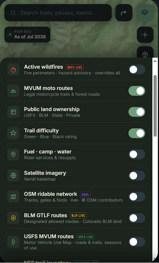
Compare motorcycle and OHV route designations with USFS MVUM, BLM GTLF, CPW and mapped road-network context, including available seasonal-use details.
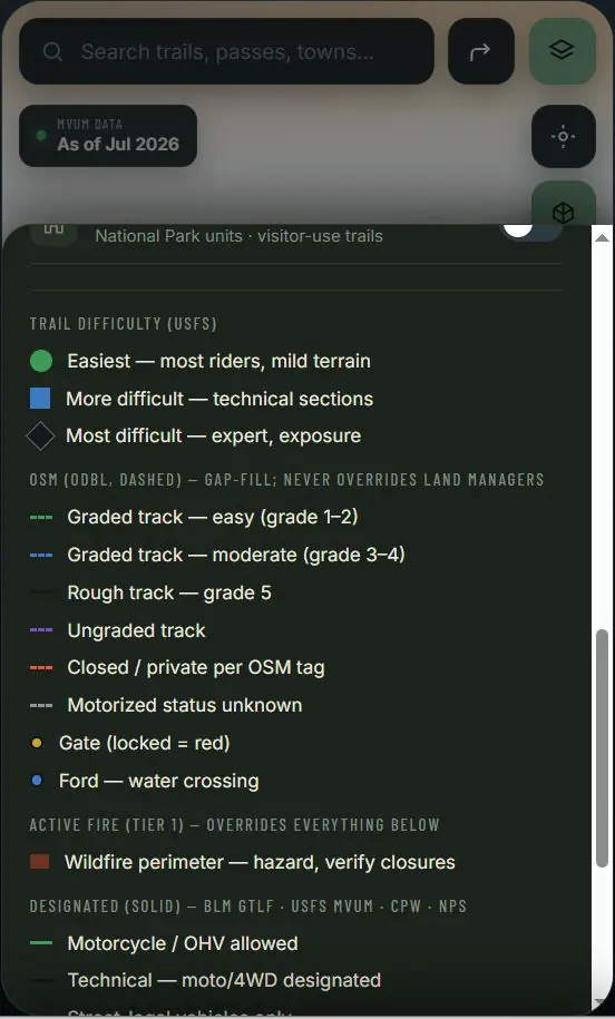
Compare satellite, topographic, public-land ownership, trail difficulty, wildfire awareness, gates, water crossings and services before committing to a route.
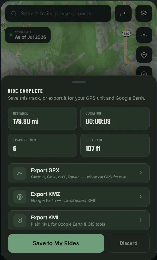
Save existing trail tracks, mark conditions, and export universal GPX, KML or KMZ files for compatible GPS units, desktop GIS and other mapping apps.
One map. Clearer answers.
Topo Colorado organizes complex multi-agency information from USFS MVUM, BLM GTLF, CPW, NPS, OpenStreetMap and wildfire sources into one motorcycle-first view. Riders can compare what each layer says, understand where coverage differs, and verify the final access decision against current land-manager direction.
Terrain you can understand
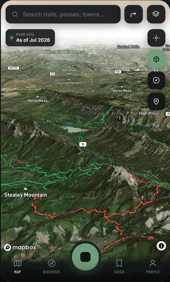
Three-dimensional terrain helps riders see passes, valleys, exposure and route connections that a flat line can hide. Compare the climb with trail difficulty and distance to estimate time to traverse, weather exposure, fuel range and water margins before the ride becomes a decision on the side of a mountain.
From plan to track
Carry selected map areas beyond cell service on mobile. On desktop, save existing trail tracks and export GPX, KML or KMZ files for a compatible GPS unit, Google Earth, desktop GIS or another mapping app—without locking ride data into one platform.
Export existing routes as GPX for GPS devices or KML and KMZ for Google Earth and GIS workflows.
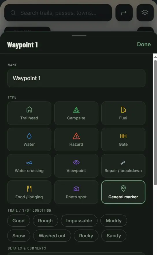
Mark trailheads, camps, fuel, water, gates, hazards, repairs and current trail conditions for ride planning.
Read source attribution, designated vehicle use, seasonal dates, route class and available trail details.
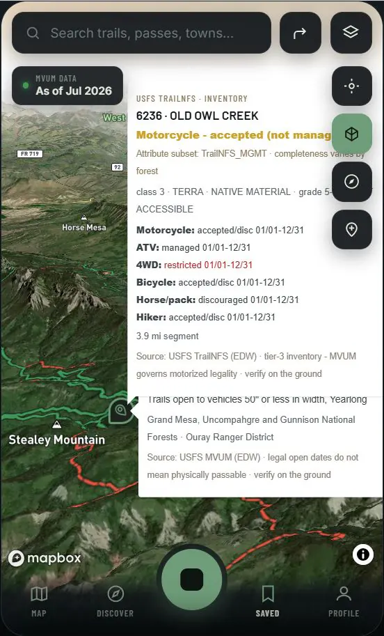
Colorado is the feature
From Front Range day rides to high-country passes and Western Slope backroads, Colorado riders cross forests, BLM districts, state lands, changing seasons and fast-moving hazards. Topo Colorado is designed around those local agencies, datasets and decisions instead of forcing motorcycle planning into a generic nationwide trail workflow.
Direct answers for Colorado riders
These concise answers explain how Topo Colorado handles route designations, multi-agency context, seasonal closures, portable GPS files and ride margins. They are planning guidance; current signs, gates, emergency orders and land-manager direction always control.
Topo Colorado combines USFS MVUM, BLM GTLF, CPW and mapped road-network context in one motorcycle-first view. Riders can compare agency designation, seasonal-use details, public-land ownership, difficulty and hazards before choosing a route. Current signs, gates, closures and land-manager direction always control access on the ground.
The best app depends on the ride, but Topo Colorado is purpose-built for ADV and dual-sport riders who need Colorado-specific, multi-agency context. Unlike broad off-road platforms, it organizes motorcycle route designations, seasonal windows, ownership, wildfire awareness, three-dimensional terrain and portable GPS exports around decisions riders make before and during a trip.
Topo Colorado lets riders save existing trail tracks and export portable GPX, KML or KMZ files for compatible GPS units, desktop GIS software and other mapping apps. USFS MVUM information supplies land-manager designation and seasonal context; exported files preserve the route for the rider’s chosen navigation workflow.
Topo Colorado displays seasonal-use details associated with available land-manager data so riders can identify routes that may change by date, district or vehicle class. Because emergency orders, weather, gates and field conditions can change faster than published datasets, the map provides planning context—not a guarantee that a route is currently open.
Topo Colorado helps riders evaluate time to traverse versus simple distance by comparing terrain, difficulty, elevation, services and route context. Fuel, water, camp, gate, crossing, hazard and repair waypoints support margin planning. Riders remain responsible for estimating pace, range, weather exposure and reserves for their motorcycle and experience level.
onX Offroad, Gaia GPS and REVER serve broad outdoor or powersports audiences. Topo Colorado is the motorcycle-first alternative for Colorado: it brings USFS MVUM, BLM GTLF, CPW, public-land, seasonal-use, wildfire and 3D terrain context into one rider workflow, then keeps saved trail tracks portable through universal GPX, KML and KMZ exports.
Explore Topo Colorado
Jump directly to the feature information you need. Every link stays within this marketing homepage while the complete mapping application remains in early access.
Create a Colorado ADV plan around terrain, time, fuel, water and portable GPS files.
Compare designated motor routes, land-management context and data coverage.
Review seasonal-use and closure context, then verify the responsible source.
Field knowledge meets GIS
Topo Colorado is a Denver-based mapping project built by a lifelong motorcyclist with more than two decades of field, infrastructure, survey-support and geospatial experience.
The goal is direct: make Colorado’s fragmented public route data easier to compare, understand and carry from a desktop plan to the saddle—without presenting reference mapping as a boundary survey or a guarantee of legal access.
Follow the buildComing soon
Join the early-access list for development updates, launch news and opportunities to test the map with real Colorado ADV and dual-sport routes.
Request Early Access