Safety information belongs to every rider
The safety layers are free. On purpose.
Some information is too important to lock behind a subscription. Topo Colorado keeps wildfire awareness, closure orders and public-land ownership free for every rider — no account tier required — because knowing where a fire is burning, where an area is closed by law, and whose land you're about to cross are decisions that affect your safety and your standing on the trail. We charge for depth and convenience. We don't charge for staying out of harm's way.
Active wildfire awareness — always free
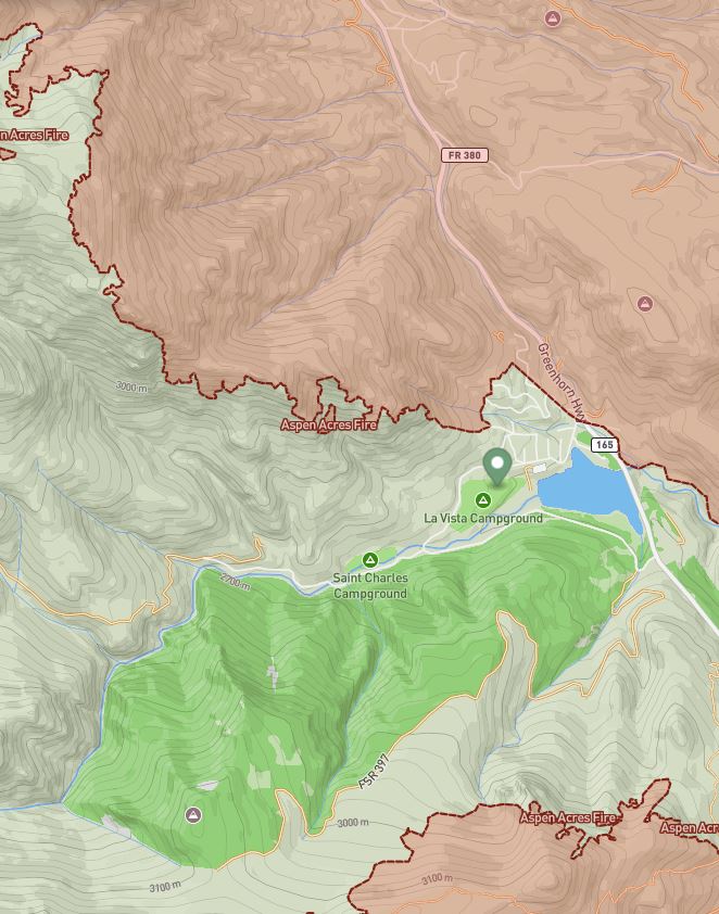
Near-real-time wildfire perimeters, sourced from national interagency fire data, sit above every other layer on the map. A fire perimeter is a hazard advisory, not a legal closure — it shows you where fire is currently mapped so you can plan around it. This layer is free for every rider, every season, with no upgrade required.
On-the-ground rule: A mapped perimeter supports planning awareness. Current evacuation notices, emergency orders, posted signs and direction from incident personnel always control.
Closure orders — the legal “no,” free to see
When a land manager closes an area by law, Topo Colorado shows it. Forest-order closures render as clearly marked prohibition zones with the order details behind them. This is the difference between “no data” and “closed” — and it's information no rider should ever have to pay to see. Always free.
Source first: Topo Colorado is designed to surface the available order and its context. The current order document and responsible land manager remain the authoritative source.
Public and private land ownership — free, because it's a legal-exposure question
“Am I about to ride onto private property?” is one of the most consequential questions a rider can ask — it affects your legal exposure and the reputation of every rider who comes after you. Topo Colorado keeps public and private land-ownership context free for exactly that reason. Public parcel data is reference information, not a boundary survey, and current signs and land-manager direction always control — but you should never be charged to see it.
Reference mapping: Ownership and parcel layers provide context for responsible planning. They do not establish a surveyed boundary or replace permission from the landowner.
Ride informed. Tread lightly. That part's on the house.
Join the early-access list for development updates, launch news and opportunities to help test Colorado's motorcycle-first trail map.
Request Early Access