Locating a section corner on a map is one step in survey research. Reviewing records, comparing evidence, and evaluating what is found in the field are also essential. Colorado DORA monument records are one important source for understanding a corner’s recorded history; they are not the entire chain of survey evidence.
As established in our guide on reading township, range, and section, understanding the grid is essential. The mapped survey framework must be considered alongside the official records and physical evidence; not every mapped coordinate is a verified field position.
This guide breaks down what Colorado Department of Regulatory Agencies (DORA) monument records are, what information they contain, and how Topo Colorado’s PLSS Monument Records platform helps bridge the gap between a geographic location and the official state repository.
What is a DORA Monument Record?
Colorado’s State Board of Licensure for Architects, Professional Engineers and Professional Land Surveyors operates under DORA. A monument record documents a surveyor’s observations and work relating to a survey corner, including the monument and supporting references. This guide explains how to research those filings; it does not define when a filing is legally required.
These records act as a public archive. They help preserve information about PLSS corners for later research and recovery. Record availability, completeness, and legibility vary; a filed record must still be evaluated with the other relevant survey evidence.
The Anatomy of a Monument Record
While historical formats vary, a modern Colorado monument record generally contains a standardized set of critical information:
- Corner Designation: The specific location on the PLSS grid, identified by Principal Meridian, Township, Range, and Section.
- Description of Monument Found: A detailed account of what the surveyor discovered in the field (for example, cap material, pipe size, identifying marks, and condition; any illustrative wording here is not a real record citation).
- Description of Monument Set or Restored: If the original monument was missing or deteriorated, the surveyor details what new physical marker was placed.
- Accessories and Reference Points: Measurements and bearings to nearby physical objects (witness trees, fence corners, utility poles, or reference monuments) that help locate the corner if the primary monument is destroyed.
- Sketch or Diagram: A visual representation of the monument and its surrounding accessories.
- Surveyor’s Certificate: The signature and seal of the Colorado Professional Land Surveyor taking responsibility for the record, along with the date of the field work.
The Challenge of Traditional Search Workflows
The legacy DORA search form uses text fields for principal meridian, township, range, index reference, and received date. Moving from a mapped location into that form requires translating geographic context into the appropriate identifiers.
Before heading to the field, a survey technician would typically need to:
- Identify the project boundaries on a county map or GIS platform.
- Cross-reference that location to determine the correct Principal Meridian, Township, Range, and Section.
- Open the separate state DORA search portal.
- Enter the corresponding township, range, meridian, and DORA index reference as appropriate. Section numbers help orient the research, but the form has no standalone Section field.
- Sift through the results to find the applicable PDFs.
This disconnect between the geographic location (where you are looking) and the document database (how you search) introduces friction and the potential for data-entry errors.
| Start on the map | Check in DORA |
|---|---|
| Project location and selected corner | Principal meridian, township and range |
| Section and corner designation | Index Ref Number and Index Ref Letter—not the section number |
| Available attributes and calculated references | Search results to inspect and compare with the intended corner |
Using the DORA Search Fields
Use the official DORA search form and its entry instructions as the reference when searching manually. At least one field is required; adding relevant identifiers can narrow a large result set.
Township and range entries include directions. For example, the form’s numeric convention represents T3S as 03.0S and R68W as 068.0W. These are formatting examples, not a verified corner search.
The Index Ref Number and Index Ref Letter identify a position in DORA’s indexing system. They are not interchangeable with a section number. Preserve leading zeroes and meaningful decimal formatting: the portal warns that different character forms can return different results. The Date Received filter describes receipt by the repository, not necessarily the survey’s field date.
When a Search Does Not Find the Expected Record
- Check the location reference. Compare the meridian, township, range, directions, and index fields with your source material. Treat calculated references as a starting point to verify.
- Widen the search thoughtfully. Remove an uncertain index filter and review township results. For corners on township boundaries, consider the adjoining township and compare the documents carefully.
- Separate an empty result from an unavailable service. A failed lookup or unavailable portal does not show that no record exists. Retain the identifiers so the search can be repeated later.
- Compare the evidence. Review corner designation, monument description, accessories, dates, and any notes about prior work. Multiple records may relate to the same corner; the newest record is not automatically a complete replacement for earlier evidence.
- Use additional repositories when needed. County survey records, recorded plats, and federal survey records may contain relevant material beyond DORA’s index.
Bridging the Gap: A Map-First Workflow
Topo Colorado was designed to reduce the friction of jumping between disconnected research interfaces. Instead of requiring you to master text-based government search forms first, it provides a spatial starting point.
Here is how a map-first workflow functions on the platform:
- Start with the Geography: Open the statewide map and navigate directly to your project area. You don't need to know the Township and Range before you start; the map provides that context visually.
- Select the Target Corner: Click on the specific PLSS corner point you need to research.
- Initiate the Source Search: Review the available coordinates, source attributes, and resolved or calculated PLSS search identifiers. The panel offers a source action when the relevant information is available.
- Bridge to DORA: By executing the search action, the platform uses the geographic context of the selected point to bridge you directly into the official DORA research pathway for the selected location. Confirm that the returned identifiers and documents describe the corner you intend to research.
Crucial Distinctions in Record Retrieval
It is vital to understand the relationship between Topo Colorado's mapped geometry and the state's document database:
- A Coordinate is Not a Document: As noted in our corner records introduction, a coordinate mapped on the platform represents the location represented in the source dataset. It does not automatically guarantee that a licensed surveyor has filed a modern DORA document for that specific location.
- A Search Pathway, Not a Guaranteed PDF: For most of the state, clicking the DORA search link from a point on our map initiates a search workflow using the available resolved or calculated reference values. It does not guarantee that a matching PDF exists in the state repository.
- The Pilot Exception: We are currently operating a verified document-index pilot in Routt County, where the platform tests more direct document matching. Do not assume equivalent verified indexing across all counties, or a one-to-one relationship between every point and every document. A corner can have multiple records.
Free Exploration and Pro Features
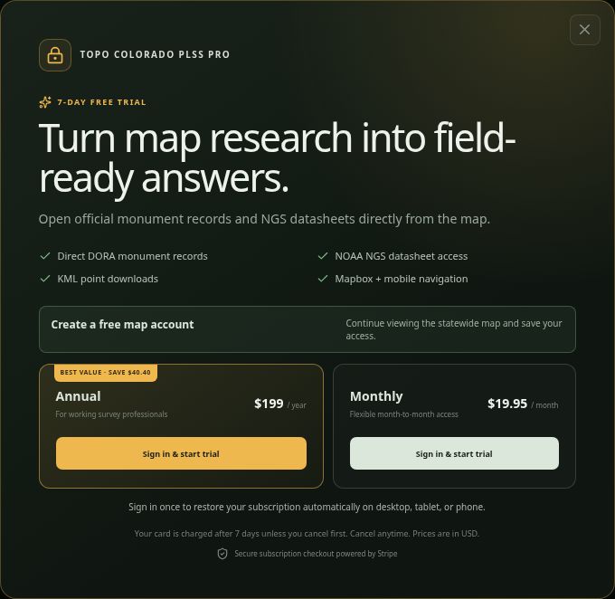
Government monument records are public resources, and they remain so. A Topo Colorado subscription does not charge for the public records themselves; it pays for the integrated mapping workflow, spatial context, and convenience tools.
Anyone can use the statewide map to freely explore county boundaries, pan, zoom, toggle PLSS layers, and inspect the coordinates and identifiers of a corner.
When you are ready to execute a protected action—such as bridging directly into the official DORA record search pathway for a selected point, downloading KML research points for compatible mapping software, or accessing routing tools for field navigation—Pro access is required. Visitors without access see free-account and paid-plan options. Creating a free map-viewing account alone does not unlock Pro tools; existing subscribers and authorized reviewers retain their access.
Visit the product landing page to view current PLSS Pro plans and subscription details.
Start Your DORA Monument Research
DORA filings can help you understand what a surveyor found, what work was performed, and which references supported the recorded corner. Begin with the location, confirm the search identifiers, and evaluate the documents alongside your other evidence. The map supports research; it does not establish a property boundary or authorize entry onto land.
Ready to streamline your survey research?
Open the Colorado PLSS Research Map to explore the geographic interface and inspect available survey information before creating an account.